
Recent beach erosion along the famed Byron Bay stretch from Clarkes Beach to Main Beach has been in the media lately. The embayment’s shorelines were in a vulnerable state last week when weather forecasts predicted storm waves to coincide with higher-than-normal tides peaking on Monday and Tuesday this week.
Our engineers have been busy collecting data to understand both the storm erosion and why the coast was in such a vulnerable state. The time lapse video provides some insight into headland bypassing and the eroded state of the beach before the storm hit. Headland bypassing is a bit like a traffic jam for sand. In 2019 Cape Byron and a lack of southern swell caused the slowdown in the flow of sand. While sand was not moving around the Cape inside the bay it was business as usual with sand continuing up the coast on its typical northward migration. This situation, akin to a uni students bank balance with more going out than coming in, resulted in an eroding embayment shoreline with Clarkes Beach and Main Beach the most effected.
The good news is that in 2020 the traffic jam cleared and sand from the south has started flowing into the embayment. The video below shows the sand first widens Wategos Beach around February. By the end of May, a large and growing slug of sand can be seen at The Pass, providing some nice surfing waves. By December, a sand spit reaches the shore at Clarkes Beach providing a much-needed natural sand buffer just in time before the latest weather event arrived on Monday. But unfortunately, just to the west Main Beach remains vulnerable.
The results of four drone surveys conducted by our engineers throughout 2020 were compared to assess the relative erosion within the embayment. ‘Erosion hotspots’ have been identified as regions where the erosion relative to the July 2019 survey exceeds 2 metres. The sand deficit (erosion is shown in red) is clearly observed to be moving in a northward direction. Simultaneously, the sand slug previously stagnant at The Pass has accelerated and is now filling in the southern end of Clarkes Beach (shown in Blue). The acceleration is due to the more easterly waves during the recent storm. These easterly waves, more common in summer and during La Niña, are able to get into the southern hook of the bay and drive sand west towards Main Beach.

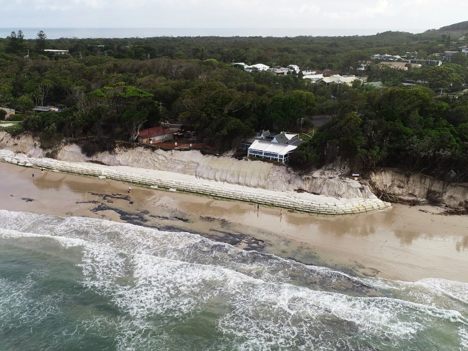
Aerial photo of Clarkes Beach Café on 15 December 2020

Change in beach profile at Clarkes Beach
With La Niña in full effect, this week’s early summer storm brought maximum wave heights over 10m in height from easterly direction and half a meter of storm surge on top of the high tides.


Our engineers have been out to survey the damage within the bay one day following the peak of the event and recorded the below video. The depleted areas between the Jonson Street rock walls and Clarkes Beach are in stark contrast to the sandy shores around The Pass.
Eventually the sand at the Pass will move in to replenish the beaches but with the storm behind us and the bulk of a La Niña and the 2020/21 storm season ahead of us, Byron Bay’s beaches remain in a highly vulnerable state.
Nearby at the Jonson Street rock structure, the extremely low levels have unearthed local history. Some neatly arranged timber piles are sticking above the sand (see pic). These 100-year old piles (in immaculate condition!!) are all that remains of a platform that was built between Jonson Street and Fletcher Street in 1919 (see below photographs).

source: facebook

source: www.imagesofbyronbay.com.au
Speaking of history does anyone out there know anything about this photo?
